Ocean Tech
How does Sentry know where it is? New smarts keep the autonomous vehicle on track

By Hannah Piecuch | January 25, 2023
Scientists believe an undersea volcano off the coast of Washington and Oregon will erupt in the next decade. Precise measurements of seafloor changes in that region are key to anticipating the timing of this eruption, measurements AUV Sentry is now more capable than ever to make.
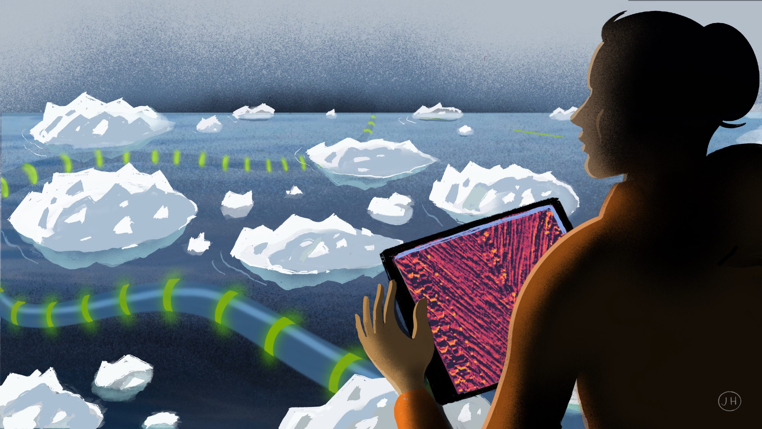
Making maps of the ocean floor is what autonomous underwater vehicle Sentry does best. But once underwater, it can drift, and the area the vehicle thinks it is mapping may not correspond to its actual location.
This isn’t an issue when making maps of unexplored sea floor—one of the main reasons Sentry was designed. But it is a problem when scientists are observing sea floor changes year-to-year to track volcanic activity.
In spring 2022, Sentry acquired some new smarts, in the form of software developed by engineers at MBARI (Monterey Bay Aquarium Research Institute) and adapted by the Sentry Team, which enable the vehicle to course correct as it goes, using a map of the area to recognize where it is.
“Once Sentry submerges it uses dead reckoning,” said Sentry team lead Sean Kelley. “It knows where it came from and its distance, time, and direction. But as it drives a straight line, the vehicle has no idea that it has drifted.” This is where the new software comes in.
Since 2006, the National Science Foundation (NSF) has funded research to do repeat mapping of Axial Seamount. By measuring how much the surface of the summit has risen, scientists are studying the cycle of in this volcano: where the magma is stored before an eruption and how much the chamber beneath the surface fills with magma before it erupts. This seamount is an ideal study site because it erupts every ten to twenty years and is only a day’s journey off the coast of Oregon. Also, it has a 40-year history of being studied, and hosts many real-time sensors as an Ocean Observatories Initiative location.
For the mapping portion of the project, the group needed a vehicle to repeat the same lines in a spider web pattern for 20 kilometers (~12 miles). Before using the MBARI software, Sentry could drift up to 40 meters (~130 feet) on some of the dives, which made comparing changes to the ocean floor difficult.
“Navigation is the hardest part of doing underwater surveys,” said David Caress, a principal engineer at MBARI who led the team that adapted new software for use on Sentry. “As soon as you are not at the sea surface and don’t have GPS, you have to do other kinds of navigation.”
The software Caress and his team developed uses terrain relative navigation, which works by loading a pre-existing map into the vehicle and then using the real time seafloor map collected during the dive to figure out its position and make corrections.

Developing the software was one thing; testing it on the vehicle during an ocean dive was another. There are computer systems that allowed the MBARI and Sentry Teams to simulate using the new software on a dive, but in order to try it in the ocean, they needed to go to sea together. In spring 2022, both teams headed to sea on an expedition led by William Chadwick (Oregon State University) with co-principal investigators Scott Nooner (University of North Carolina Wilmington) and Caress.
On the last two missions of the expedition, they ran the new software during actual dives, and Sentry was able repeat missions within ten meters of its original course.
“In terms of working with the Sentry Team, I think we were all pretty thrilled with the result,” Caress said. “When you have a project where everyone is focused and really competent, a set of difficult problems instead becomes interesting. Our proposal to continue this project has been funded by NSF, so we will be able to go back out and use terrain relative navigation again with Sentry three times over the next six years.”
This new capability is “a pretty big tech step,” said Kelley. Using terrain relative navigation for Sentry is still in development, he added, but it is something the team hopes to offer to other principal investigators in the near future.
“Adding repeat mapping to Sentry’s skill set is going to be especially valuable wherever you have seafloor changes from an active volcano,” Caress said. “It also enables making repeated autonomous measurements, such as taking pictures of the same place on the seafloor, or taking a water sample in the same location.”
And now, Sentry has a way to self-correct when it drifts.

The terrain relative navigation software for Sentry was developed for use on an NSF-funded expedition lead by co-principal investigators Scott Nooner, William Chadwick, and David Caress. Caress and MBARI Engineer Kent Headley worked with the Sentry Team to integrate the new software, test the operation, and use it while running surveys. The terrain relative navigation algorithm and software was developed by Stanford Professor and MBARI Adjunct Scientist Stephen Rock, several of his students, and Rob McEwen, Rich Henthorn, Kent Headley, and the Autonomous Systems Group at MBARI.